A question came up recently in a conversation about the different products and stages of processing and presenting data captured by UAVs. I’ll use a recent construction monitoring project to demonstrate some nice examples of the various stages of the photogrammetric processing workflow. This will also show and describe some of the products and deliverables the GEO Jobe UAV crew is creating for our clients.
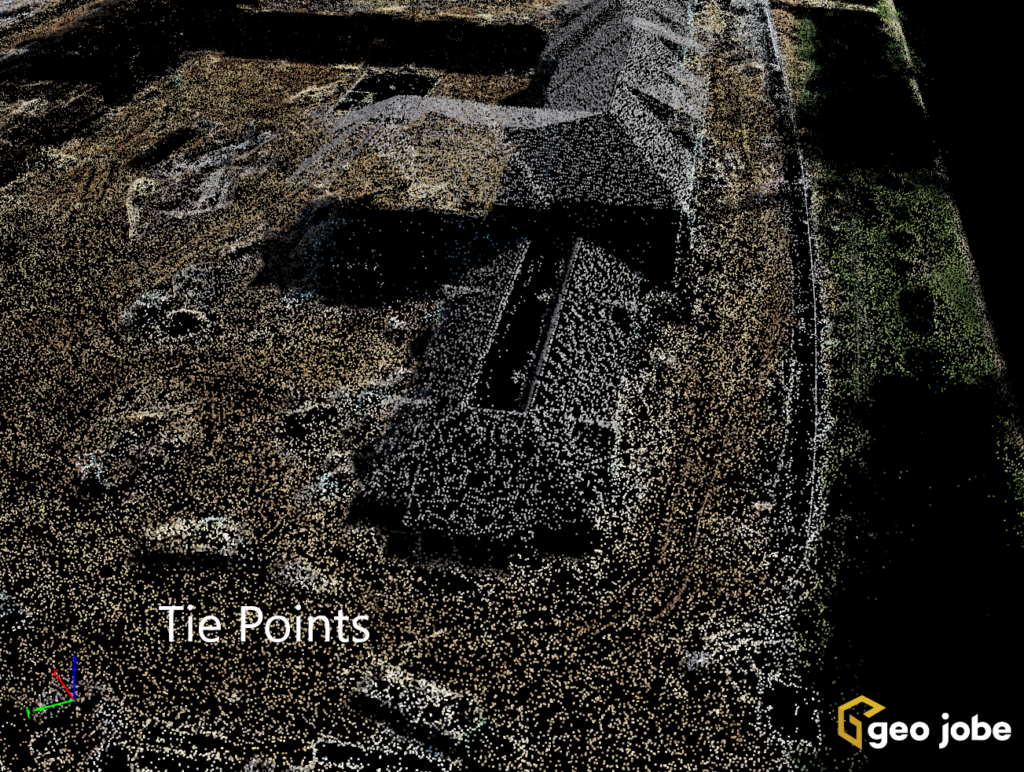
Tie Points are the most basic building block of the photogrammetric process. They are points with coordinates that the process recognizes as matching and being in the same place in multiple photos. This project has 470 photos. Depending on the amount of overlap in a mission, tie points can be in 50-70 different photos.
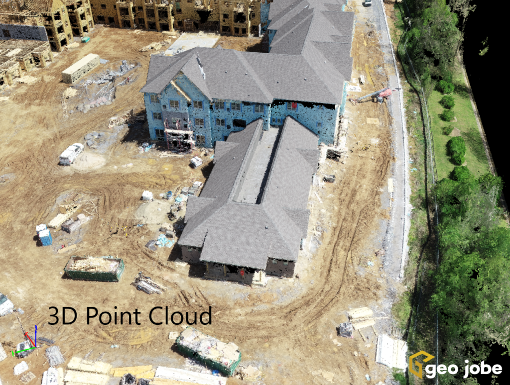
The 3D Point Cloud is an enhanced and densified version of the tie points. This project has 25 million points in the cloud. Each point has a coordinate for the x,y, and z locations, in this case, State Plane coordinates. The processing also adds color to the points for better visualization. The point cloud is a result of not only the photogrammetric process, but is also a result of the LiDAR approach to data capture. Even though they are different approaches LiDAR and Photogrammetry do share some similar outputs. We use tools, for example, to accurately extract planimetric features from clients’ point clouds. The GEO Jobe UAV Crew can extract features – edges of pavement, underground utilities before they are covered, sidewalks, poles, curbs, drainage, and storm water features – from the cloud, regardless of how the data was captured. These features can be used for as-builts and be imported into CAD and design programs. The point clouds are also useful in BIM technology for asset and facility management purposes.
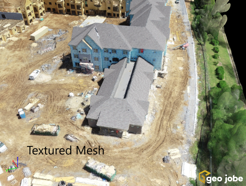
Finally, the textured mesh stage uses the individual images to “paint” or fill in gaps in the point cloud points to create the 3D model that looks true to life.
For an even more realistic visualization, we can create virtual flythrough videos from either the 3D point cloud or the Enhanced 3D model. These are great for progress reports or community update meetings or social media posts.
More GEO Jobe UAV Articles
A Check List For Flying UAV
Flying High: Reflections on GEO Jobe’s UAV Division with Jeff Lawrence
Drones: That Sounds Fun!