


Unleashing the Power of Automation with Scheduler for ArcGIS
The launch of GEO Jobe’s latest software, Scheduler for ArcGIS®, is just around the corner, and we are currently offering select users free limited access during our closed beta testing, now through January 2024.
In preparation for its release, here’s an introduction to Scheduler and what users can expect from this game-changing software application.
In this article, we’ll break down:
- What Scheduler for ArcGIS is
- Top Features to Explore
- Other Capabilities
- How To Become a Beta Tester
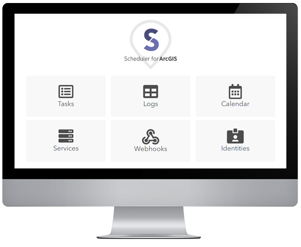
What is Scheduler for ArcGIS?
Scheduler for ArcGIS is a powerful tool that enables users to customize and automate the otherwise time-consuming tasks associated with managing an ArcGIS® Organization.
By combining multiple tools and workflows, Scheduler allows users a greater variety of options for managing geospatial content than ever before. Additionally, Scheduler allows users to create tasks that are more responsive, giving them more control over what happens in their ArcGIS Organizations by leveraging webhooks
Scheduler also supports back-end operations, such as starting and stopping services, rebuilding spatial indexes, publishing services, monitoring server health and status, and monitoring and responding to events based on server logs.
Top Features to Explore in Scheduler
Scheduler for ArcGIS offers a plethora of features and capabilities designed to empower users in simplifying their workflow and increasing efficiency and productivity. Some key features users can expect with Scheduler include:
- Scheduling routine database reindexing operations based on your configured database connections, improving performance across any of your databases
- Creating your own scheduled tasks with custom sequences of steps, with a variety of operations for workflow configuration and error handling
- Triggering tasks based on organizational events using webhooks for items, users, and groups
- Managing webhooks for items, groups, and users in bulk for both Scheduler and other applications
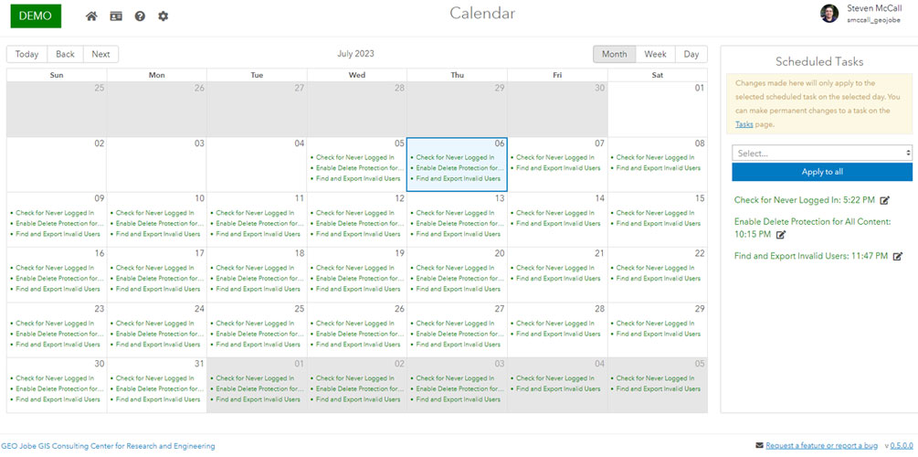
- Running preconfigured tasks on a custom schedule to automate routine operations
- Using the “Cancel Geoprocessing Jobs” feature to choose between current jobs that are submitted, waiting, or executing that have been running for a certain amount of time, and cancel those automatically
- Scheduling your custom scripts to run and generate your admin reports automatically as part of your routine workflow
Other Capabilities
- Alert When Sensitive Data is Shared: Scheduler for ArcGIS can watch all content shared publicly and look for sensitive information, such as Social Security Numbers, credit card numbers, or other types of Personal Identifiable Information (PII) based on your organization’s requirements.
- Granular Control of Your Map Services: Scheduler for ArcGIS can start, stop, or restart your map services, or publish map services from an external data source such as KML/CSV/GeoJSON.
- Ensure Optimization of Your Spatial Data and Underlying Tables: Scheduler for ArcGIS can rebuild your geospatial data’s spatial and/or attribute indexes on a schedule, or dynamically on every certain number of records updated/inserted.
- Monitor Geoprocessing Services Performance: Scheduler for ArcGIS can watch your geoprocessing services for jobs that are taking longer than expected to run — and can even cancel those jobs dynamically if they reach a threshold of your choosing.
- Proactively Report on the Progress of Tile Caching: Scheduler for ArcGIS can provide more granular reporting and updates around long-running operations such as generating a new Tile Cache.
- Run Administrative Reports & Custom Scripts: Schedule and run ArcGIS administrative reports automatically. If you have your own regularly run scripts in your organization as part of your daily workflow, use the Scheduler for ArcGIS collection of tools to wrap additional functionality around that process without having to write a single line of code.
- Get More Value From ArcGIS Server Log Files: Scheduler for ArcGIS can query server logs from ArcGIS Server, etc., and format them into a more easily readable report in CSV form. It can watch for logs based on any property, including level, code, source, or text (for example, critical errors), and dynamically alert you when they occur. It also includes an interactive Log Viewer that you can use to search the full logs in a variety of powerful ways.
How Can I Become a Beta Tester for Scheduler?
User input is a valuable resource for improving our products and services and ultimately offering new products and features designed to make your work life easier in the long run. Right now for a limited time, GEO Jobe is accepting applicants to participate in our final round of testing before the release of Scheduler for ArcGIS on January 8, 2024.
This allows real users exclusive access to explore Scheduler for themselves and provide feedback that can uncover potential bugs or usability issues prior to public release. Please note selection is not guaranteed for every applicant, and software licensing is only active during the beta period.
Interested in being one of the first to harness the power of Scheduler for ArcGIS?
Want to be an early adopter of Scheduler for ArcGIS as soon as it’s released on Jan. 8? Contact the GEO Jobe Sales Team today at sales@geo-jobe.com!
MARK YOUR CALENDAR!

Register for our live webinar on Wednesday, Jan. 24, 2024, 1 P.M. CST, for a guided tour of GEO Jobe’s new Scheduler for ArcGIS application! Our software developers will showcase Scheduler’s top features and functions and answer user questions. Gain firsthand insight into the power of Scheduler for ArcGIS from the team that created it.
